Ed delves into the secrets of wetlands, brooks and streams amid the Shropshire Hills.
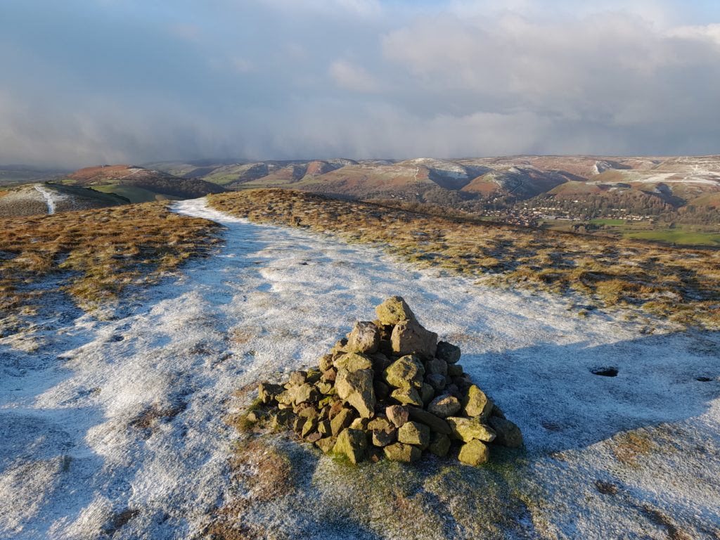
I stride up a steep grassy slope towards the jagged tooth of the Gaer Stone. Volcanic in origin, this rocky outcrop was formed during the Precambrian era, the earliest period in earth history. This makes these rocks around 200 million years older than the sandstones of the Severn Valley. Ahead of me, a kestrel hangs over the snow-capped summit ridge of Hope Bowdler Hill, tail feathers fanned by the strong breeze. I cross the ridge under clear blue skies. As I descend, the sky quickly darkens and a blizzard blows over.
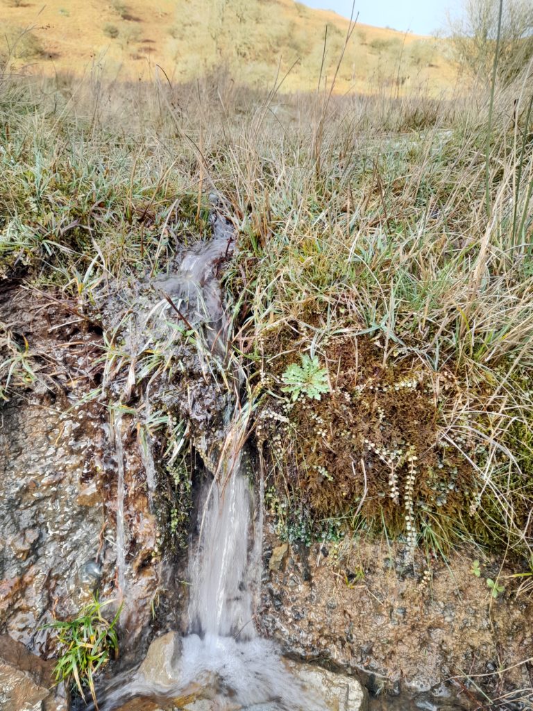
At the base of the hill, I join a drovers’ route that has offered safe passage through this rugged landscape for hundreds of years. Wingbeats in a grove of dwarf alder trees signal the presence of redwings and water. This mossy hollow is the source of a stream that will eventually join the River Severn. The water that charges the stream is captured by the surrounding hills and filtered through layers of ancient rock. The jewel-like leaves of Bog Pimpernel flow through the crystalline waters that emerge from the base of Caer Caradoc.
A mysterious fish
The stream has no name. This anonymity hides the secrets that lie beneath the mirrored waters. After flowing underneath the A49, the stream emerges in Coppice Leasowes Local Nature Reserve. Each spring, the mysterious brook lamprey spawns in the shallows here. The lamprey is a primitive fish shaped like an eel. Adults reach around 15cm in length. Rather than gills, they have a line of air holes behind their head. Young lamprey are tiny, almost transparent filter feeders that live buried in the silt at the bed of the stream.
A glance at the 1840 Tithe Map of the area reveals a tapestry of small fields and woodlands. Part of Coppice Leasowes was once known as Broad Meadow, an indication that this was once a floodplain meadow. Still today the waters of the Ash Brook spill across the field, creating wetlands that reflect the winter skies and will soon sparkle with the white flowers of water crowfoot. I approach the wetland edge. From a couple of metres away a pair of jack snipe burst into flight. They settle again somewhere on the far bank and disappear against the backdrop of rushes, thanks to their cryptic colouration. Snipe are wading birds, attracted by the invertebrates that thrive in these muddy fringes.
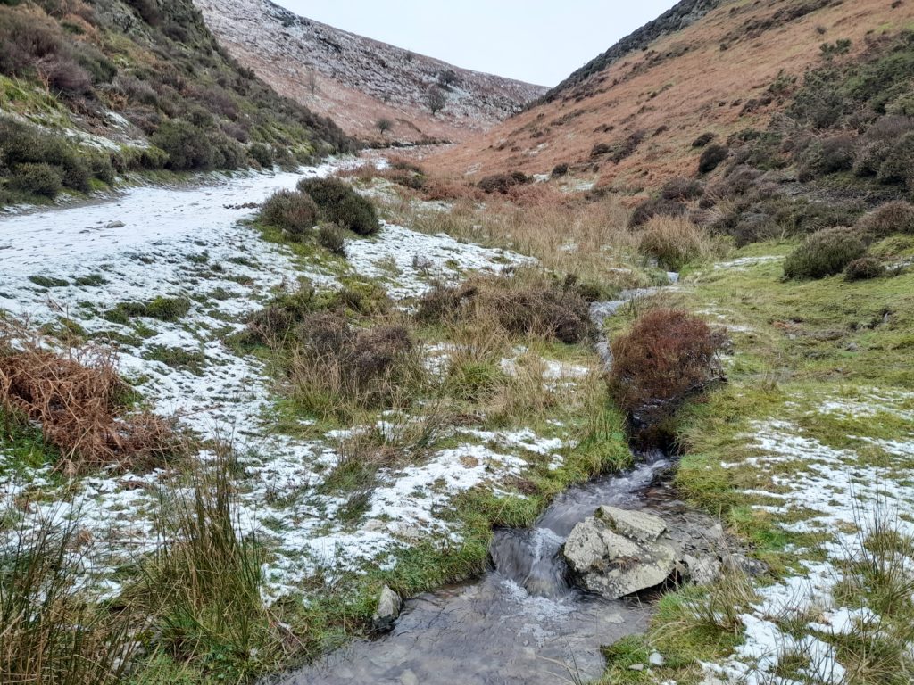
I leave Coppice Leasowes and follow the Ash Brook as it weaves past wheelie bins and garden fences. It is the upper reaches of the Ash Brook that define it, for this is a true hill stream, shallow sparkling waters bouncing over the rocky substrate. Beyond Carding Mill Valley, the landscape narrows and steepens.
A withered hand
The upland valley resembles a hand, each finger a narrow spit of land that creeps up to the very edge of the Long Mynd plateau. The dark veins that flow down the fingers are marked by the presence of soft rush and lush green mosses that trace the gently flowing head waters of the Ash Brook. Clusters of tiny flowers still cling to the side of some of the rush spikes. They are withered and brown now, capped with a dusting of snow.
The spring sunshine will soon bring colour back to these watery places. The luminous pink flower heads of marsh thistle will erupt between the tussocks of grass. Finely divided flower heads of ragged robin and the lilac blooms of marsh violet have a more subtle charm. Violet leaves offer food for caterpillars of the small pearl-bordered fritillary butterfly. I have fond memories of a summer spent surveying these butterflies in the wet flush habitats on the eastern edge of the Stiperstones. Set against a vibrant orange backdrop, the wings are punctuated with black markings and lined with white ‘pearls’. The butterfly is only on the wing for around 6 weeks each year, from the middle of May.
The view from the summit of Pole Bank is a 360-degree winter skyscape. The Shropshire Hills feel like an extension of the wild Welsh uplands into the English Midlands. From up here my eye and imagination are always drawn to the west. Beyond the Devil’s Chair and Corndon Hill, and visible on a clear day, stand the mountainous slopes of Plynlimon. It is here that the source of the Severn can be found. Hydrologically speaking, the source is classified as the stream that joins the river furthest from the sea. In reality, the Severn is born again wherever water oozes from boggy hillsides throughout the catchment. That same water is the harbinger of spring in these frozen uplands.
Do one thing for wildlife
Stepping Stones is a National Trust project that is looking for volunteers. The aim is to connect the habitats of Long Mynd and Stiperstones by creating wildlife corridors across the Upper Onny Valley. Priority habitats include road verges, hedges and hillside wet flushes. Volunteer opportunities include carrying out timed counts of small pearl-bordered fritillary and helping with breeding bird surveys. For more information, please see the project webpage at: https://www.nationaltrust.org.uk/carding-mill-valley-and-the-long-mynd/features/stepping-stones-project
In each issue, WW! nature expert and Shropshire Council’s Parks and Greenspace Officer Edward Andrews looks at the changing seasons.
You can follow Ed on Twitter: @shropshirewild